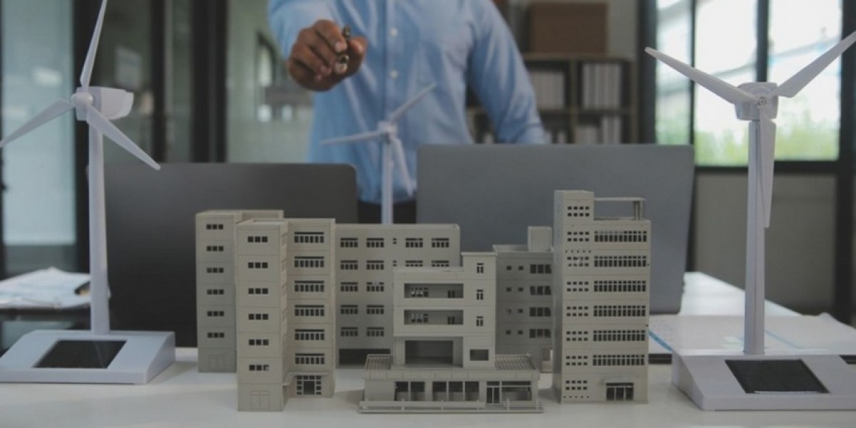
Model making in Dubai plays a vital role in the development of climate-responsive residential zones. One key element of this process is the visualization of native landscaping patterns. These landscaping strategies are essential in desert climates where water conservation, shade generation, and thermal regulation are top priorities.
Through scale models, both physical and digital, designers can study how native vegetation and landforms can improve environmental performance, community well-being, and long-term sustainability.
The Role of Native Landscaping in Dubai’s Urban Design
Native landscaping refers to the use of plants, trees, and ground cover that are naturally adapted to the local climate. In Dubai, this includes drought-tolerant species like ghaf trees, desert grasses, and resilient shrubs. These plants require less irrigation, resist high temperatures, and support local biodiversity.
In climate-responsive residential zones, native landscaping reduces the need for mechanical cooling. Trees can offer shade for buildings and walkways. Vegetation cools the air through evapotranspiration. Ground cover reduces reflected heat from pavements. Model making helps integrate all these elements at the early design stage.
Physical Model Making for Landscape Integration
In Dubai, architects and landscape designers often build scale models of residential zones. These physical models include miniature trees, shrubs, and topography features. They are placed around building models to demonstrate the interaction between built and natural environments.
Designers choose materials and textures that mimic the look and density of native plants. Even in small scales, they can test how different planting layouts affect light and shadow. This helps visualize how shaded zones move across the site during the day.
By rotating the model or adjusting structures, planners can identify where trees should be placed for maximum benefit. This approach creates visual clarity for clients, government regulators, and sustainability teams.
Topography and Microclimate Representation
Model making in Dubai for climate-responsive residential zone development also includes topography simulation. Shallow mounds, depressions, and contour lines are added to physical models. These forms show how the land can be shaped to manage stormwater or create cooler microclimates.
By combining topography with native landscaping patterns, models allow designers to test low-impact development strategies. For example, swales planted with native grasses can be visualized in the model. These features slow down runoff and improve groundwater recharge.
Digital Model Making and Planting Simulation
Digital tools are widely used in Dubai’s architectural scene. Software such as SketchUp, Rhino, and Lumion helps visualize native landscaping in high detail. Designers input actual plant species data, including size, canopy spread, and seasonal behavior.
This allows for accurate renderings of how a landscape will evolve over time. Digital models also show how shadows change with plant growth. These tools are essential when planning long-term cooling strategies in residential zones.
In some advanced models, the digital landscape includes environmental simulations. Designers can test how vegetation reduces ground temperature or redirects wind flow. These insights help refine planting patterns before construction begins.
Creating Climate Zones Within a Residential Development
In climate-responsive design, different parts of a residential area may have different thermal needs. For instance, a shaded courtyard may need denser planting, while a wind-exposed corner may need low-growing shrubs.
Model making Dubai helps visualize how to apply native landscaping in each zone. Physical and digital models display layering of vegetation. They show how plant heights, spacing, and canopy density work together to provide shade and ventilation.
This process allows for smart zoning of landscape types. Xeriscaping, shaded parks, and breezy open plazas can all be tested visually. The result is a more adaptable, climate-ready community layout.
Supporting Cultural and Ecological Identity
Native landscaping is not just functional. It also supports the cultural and ecological identity of Dubai. Using indigenous plants in model making shows respect for local heritage and natural aesthetics.
Model makers can include regional features such as falaj water channels, rock gardens, and date palm groves. These traditional elements bring authenticity to the design. They also offer educational value when presenting the model to clients or the public.
In community planning presentations, these details help residents connect with the space. It shows them how the neighborhood design supports nature, water efficiency, and cultural values.
Highlighting Water Management Strategies
Water conservation is a major concern in Dubai’s residential development. Model making helps visualize irrigation systems and water-sensitive landscaping techniques. Designers use miniature pipes, drip lines, and retention basins in their physical models.
Digital models show how treated greywater or collected rainwater can be distributed to landscaped zones. These models highlight how native plants are supported with minimal water use. They also allow simulation of seasonal water requirements for each plant group.
Engaging Stakeholders with Landscape Models
Native landscaping patterns are sometimes undervalued in early-stage planning. Model making ensures these elements are front and center. Whether in a scale model or a digital walkthrough, it’s easier to communicate the environmental value of plants visually.
Stakeholders including developers, municipality officials, and environmental agencies can evaluate the impact of green spaces directly from the model. These insights support approvals, funding, and compliance with green building regulations like Estidama and Al Sa’fat.
Conclusion
Model making Dubai for climate-responsive residential zone development is an essential tool for integrating native landscaping patterns. These models bring clarity to how natural elements contribute to comfort, sustainability, and identity.
Both physical and digital models help architects, landscape designers, and planners test planting layouts, simulate microclimates, and communicate ideas clearly. In a city facing extreme heat and water scarcity, visualizing the power of native landscaping through model making leads to better, more sustainable living environments.


